 vesseltracker.com
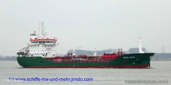
Vessel 'MINA DENIZ' IMO: 9835032, MMSI: 215086000
UTC, 42.54667, 9.54333, course: -1, speed: 0
UTC, 42.54667, 9.54333, course: -1, speed: 0
2026-02-01 10:19:14 UTC, 42.54667, 9.54333, course: -1, speed: 0
Live AIS position:
UTC. Near Borgo),
updated 2026-02-01 10:19:14 UTC.
Find the position of the vessel 'MINA DENIZ' on the map. The latter are known coordinates and path.
marine traffic ship tracker show on live map
The current position of vessel 'MINA DENIZ' is 42.54667 lat / 9.54333 lng. Updated: 2026-02-01 10:19:14 UTCDetails:
Last coordinates of the vessel:
UTC, 42.54667, 9.54333, course: -1, speed: 0UTC, 42.54667, 9.54333, course: -1, speed: 0
UTC, 42.54667, 9.54333, course: -1, speed: 0
2026-02-01 10:19:14 UTC, 42.54667, 9.54333, course: -1, speed: 0